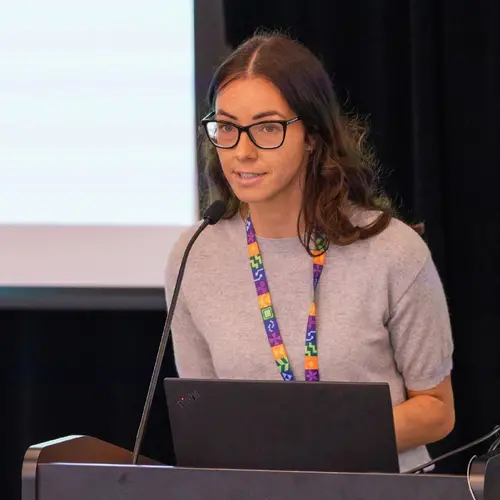
Portrait de Jeff Cardille

Jeff Cardille

Membre affilié
Professeur agrégé, McGill University, Département des sciences des ressources naturelles
Sujets de recherche
Exploration des données

Biographie

Jeffrey Cardille est professeur agrégé à l’École d’environnement Bieler et au Département des sciences des ressources naturelles de l'Université McGill. Privilégiant une approche multidisciplinaire, il emploie des techniques de pointe dans les secteurs de la télédétection, des systèmes d’information géographiques (SIG), du supercalcul, de la modélisation par simulation et des avancées en informatique. Ses recherches abordent des sujets tels que les changements dans la couverture terrestre, la connectivité des forêts et le contenu en carbone des lacs, sur des échelles allant du niveau régional au niveau mondial. Récemment, il a codirigé un grand livre de tutoriels sur Google Earth Engine auquel ont collaboré environ 100 de ses collègues, intitulé Cloud-Based Remote Sensing with Google Earth Engine: Fundamentals and Applications.

Publications

An AI system to help scientists write expert-level empirical software
Eser Aygün
Anastasiya Belyaeva
Gheorghe Comanici
Marc Coram
Hao Cui
Jake Garrison
Renee Johnston Anton Kast
Cory Y. McLean
Peter C. Norgaard
Zahra Shamsi
David Smalling
James Thompson
Subhashini Venugopalan
Brian P Williams
Chujun He
Sarah Martinson
Martyna Plomecka
Lai Wei
Yuchen Zhou
Qian-Ze Zhu … (voir 21 de plus)
Matthew Abraham
Erica Brand
Anna Bulanova
Chris Co
Scott Ellsworth
Grace Joseph
Malcolm Kane
Ryan K. Krueger
Johan Kartiwa
D. Liebling
Jan-Matthis Lueckmann
Paul Raccuglia
Xuefei Wang
Katherine Chou
James Manyika
Yossi Matias
J.C. Platt
Lizzie Dorfman
Shibl Mourad
Michael P. Brenner
The cycle of scientific discovery is frequently bottlenecked by the slow, manual creation of software to support computational experiments. … (voir plus)To address this, we present an AI system that creates expert-level scientific software whose goal is to maximize a quality metric. The system uses a Large Language Model (LLM) and Tree Search (TS) to systematically improve the quality metric and intelligently navigate the large space of possible solutions. The system achieves expert-level results when it explores and integrates complex research ideas from external sources. The effectiveness of tree search is demonstrated across a wide range of benchmarks. In bioinformatics, it discovered 40 novel methods for single-cell data analysis that outperformed the top human-developed methods on a public leaderboard. In epidemiology, it generated 14 models that outperformed the CDC ensemble and all other individual models for forecasting COVID-19 hospitalizations. Our method also produced state-of-the-art software for geospatial analysis, neural activity prediction in zebrafish, time series forecasting and numerical solution of integrals. By devising and implementing novel solutions to diverse tasks, the system represents a significant step towards accelerating scientific progress.
Early Deforestation Detection in the Tropics using L-band SAR and Optical multi-sensor data and Bayesian Statistics
Africa I. Flores-Anderson
Josef Kellndorfer
Franz J. Meyer
Pontus Olofsson
Assessing the exposure of buildings to long-term sea level rise across the Global South
M. Willard-Stepan
N. Gomez
E. D. Galbraith
E. M. Bennett
Mapping Delayed Canopy Loss and Durable Fire Refugia for the 2020 Wildfires in Washington State Using Multiple Sensors
Anika M. Anderson
Meg A. Krawchuk
Flavie Pelletier
Surface water temperature observations and ice phenology estimations for 1.4 million lakes globally
Maartje C. Korver
Bernhard Lehner
Laura Carrea
Surface water temperature observations and ice phenology estimations for 1.4 million lakes globally
Maartje C. Korver
Bernhard Lehner
Laura Carrea
Revisiting the 2023 wildfire season in Canada
Flavie Pelletier
Michael A. Wulder
Joanne C. White
Txomin Hermosilla
Revisiting the 2023 wildfire season in Canada
Flavie Pelletier
Michael A. Wulder
Joanne C. White
Txomin Hermosilla
Inter- and intra-year forest change detection and monitoring of aboveground biomass dynamics using Sentinel-2 and Landsat
Flavie Pelletier
Michael A. Wulder
Joanne C. White
Txomin Hermosilla
Inter- and intra-year forest change detection and monitoring of aboveground biomass dynamics using Sentinel-2 and Landsat
Flavie Pelletier
Michael A. Wulder
Joanne C. White
Txomin Hermosilla
Inter- and intra-year forest change detection and monitoring of aboveground biomass dynamics using Sentinel-2 and Landsat
Flavie Pelletier
Michael A. Wulder
Joanne C. White
Txomin Hermosilla
Inter- and intra-year forest change detection and monitoring of aboveground biomass dynamics using Sentinel-2 and Landsat
Flavie Pelletier
Michael A. Wulder
Joanne C. White
Txomin Hermosilla