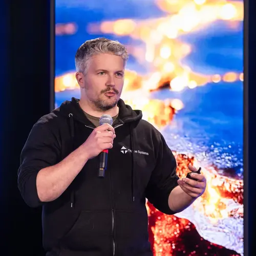
Portrait de Étienne Laliberté

Étienne Laliberté

Membre académique associé
Professeur titulaire, Université de Montréal, Département de sciences biologiques
Sujets de recherche
Vision par ordinateur

Biographie

Étienne Laliberté est professeur titulaire au Département de sciences biologiques de l'Université de Montréal, membre de l'Institut de recherche en biologie végétale (IRBV) et titulaire de la Chaire de recherche du Canada en biodiversité fonctionnelle végétale. Il dirige également l'Observatoire aérien canadien de la biodiversité (CABO).

Ses recherches actuelles se concentrent sur le développement de nouvelles approches pour la surveillance de la végétation (biodiversité végétale et carbone) basée sur la télédétection haute résolution à l'aide de drones et de la vision par ordinateur. Il s'intéresse particulièrement aux applications de cette technologie qui peuvent contribuer à atténuer la perte de biodiversité et le changement climatique, et qui peuvent avoir un effet rapide et généralisé.

Étudiants actuels

Maîtrise recherche - UdeM
Co-superviseur⋅e :
Visiteur de recherche indépendant - Université de Montréal
Maîtrise recherche - UdeM
Postdoctorat - McGill
Superviseur⋅e principal⋅e :

Publications

Arbuscular and ectomycorrhizal tree seedling growth is inhibited by competition from neighboring roots and associated fungal hyphae
Vlad Parasquive
Jacques Brisson
Pierre Luc Chagnon
Phenospectral similarity as an index of ecological integrity
Patrick Osei Darko
Margaret Kalacska
J. Pablo Arroyo-Mora
Andrew Gonzalez
Juan Zuloaga
In collaboration with the International Union for the Conservation of Nature (IUCN) Taskforce on Biodiversity and Protected Areas, countries… (voir plus) worldwide are working to develop a new systematic approach to inform the Key Biodiversity Areas (KBAs) initiative. The goal is to map KBAs from the national to global scales with a baseline international standard in support of biodiversity conservation efforts. According to the IUCN standard, one of the five criteria used to identify potential KBAs, is the Ecological Integrity (EI) of the ecosystem. Sites identified with respect to EI must have an intact ecological community and be characterized by minimal anthropogenic disturbance. In this study, a new EI metric, phenospectral similarity (PSpecM), has been developed and implemented in Google Earth Engine to identify potential forest stands of high EI from a large set of candidate stands. The implementation of PSpecM requires a network of known reference sites of high EI and target ecological units of the same land cover type for comparison to help identify potential sites of high EI. Here, we tested PSpecM on a ∼12,000 km2 study area in the Laurentian region, Quebec, Canada, using Sentinel-2 and PlanetScope (Dove) satellite imagery. Considering the phenological effect on reflectance, we found a 2,700 km2 spatial extent, equivalent to approximately 22% of the study area, commonly delineated as potential areas of high EI by both PlanetScope (Dove) and Sentinel-2. Without consideration of phenology, the total area delineated as potential areas of high EI increased to 5,505 km2, equivalent to around 45% of the study area. Our results show that PSpecM can be computed for rapid assessments of forest stands to identify potential areas of high EI on a large geographic scale and serve as an additional conservation tool that can be applied to the ongoing global and national identification of KBAs.
Coordination among leaf and fine-root traits along a strong natural soil fertility gradient
Xavier Guilbeault-Mayers
Hans Lambers
Linking aerial hyperspectral data to canopy tree biodiversity: An examination of the spectral variation hypothesis
Anna L. Crofts
Christine I. B. Wallis
Sabine St‐Jean
Sabrina Demers‐Thibeault
Deep Inamdar
J. Pablo Arroyo‐Mora
Margaret Kalacska
Mark Vellend
Imaging spectroscopy is emerging as a leading remote sensing method for quantifying plant biodiversity. The spectral variation hypothesis pr… (voir plus)edicts that variation in plant hyperspectral reflectance is related to variation in taxonomic and functional identity. While most studies report some correlation between spectral and field‐based (i.e., taxonomic and functional) expressions of biodiversity, the observed strength of association is highly variable, and the utility in applying spectral community properties to examine environmental drivers of communities remains unknown. We linked hyperspectral data acquired by airborne imaging spectrometers with precisely geolocated field plots to examine the spectral variation hypothesis along a temperate‐to‐boreal forest gradient in southern Québec, Canada. First, we examine the degree of association between spectral and field‐based dimensions of canopy tree composition and diversity. Second, we ask whether the relationships between field‐based community properties and the environment are reproduced when using spectral community properties. We found support for the spectral variation hypothesis with the strength of association generally greater for the functional than taxonomic dimension, but the strength of relationships was highly variable and dependent on the choice of method or metric used to quantify spectral and field‐based community properties. Using a multivariate approach (comparisons of separate ordinations), spectral composition was moderately well correlated with field‐based composition; however, the degree of association increased when univariately relating the main axes of compositional variation. Spectral diversity was most tightly associated with functional diversity metrics that quantify functional richness and divergence. For predicting canopy tree composition and diversity using environmental variables, the same qualitative conclusions emerge when hyperspectral or field‐based data are used. Spatial patterns of canopy tree community properties were strongly related to the turnover from temperate‐to‐boreal communities, with most variation explained by elevation. Spectral composition and diversity provide a straightforward way to quantify plant biodiversity across large spatial extents without the need for a priori field observations. While commonly framed as a potential tool for biodiversity monitoring, we show that spectral community properties can be applied more widely to assess the environmental drivers of biodiversity, thereby helping to advance our understanding of the drivers of biogeographical patterns of plant communities.
Foliar spectra accurately distinguish most temperate tree species and show strong phylogenetic signal
Florence Blanchard
Anne Bruneau
Coordination among leaf and fine root traits across a strong natural soil fertility gradient
Xavier Guilbeault-Mayers
Hans Lambers
OpenForest: a data catalog for machine learning in forest monitoring
Forests play a crucial role in Earth's system processes and provide a suite of social and economic ecosystem services, but are significantly… (voir plus) impacted by human activities, leading to a pronounced disruption of the equilibrium within ecosystems. Advancing forest monitoring worldwide offers advantages in mitigating human impacts and enhancing our comprehension of forest composition, alongside the effects of climate change. While statistical modeling has traditionally found applications in forest biology, recent strides in machine learning and computer vision have reached important milestones using remote sensing data, such as tree species identification, tree crown segmentation and forest biomass assessments. For this, the significance of open access data remains essential in enhancing such data-driven algorithms and methodologies. Here, we provide a comprehensive and extensive overview of 86 open access forest datasets across spatial scales, encompassing inventories, ground-based, aerial-based, satellite-based recordings, and country or world maps. These datasets are grouped in OpenForest, a dynamic catalogue open to contributions that strives to reference all available open access forest datasets. Moreover, in the context of these datasets, we aim to inspire research in machine learning applied to forest biology by establishing connections between contemporary topics, perspectives and challenges inherent in both domains. We hope to encourage collaborations among scientists, fostering the sharing and exploration of diverse datasets through the application of machine learning methods for large-scale forest monitoring. OpenForest is available at https://github.com/RolnickLab/OpenForest .
Root phosphatase activity is coordinated with the root conservation gradient across a phosphorus gradient in a lowland tropical forest
Xavier Guilbeault-Mayers
Soil phosphorus (P) is a growth-limiting nutrient in tropical ecosystems, driving diverse P-acquisition strategies among plants. Particularl… (voir plus)y, mining for inorganic P through phosphomonoesterase (PME) activity is essential, given the substantial proportion of organic P in soils. Yet the relationship between PME activity and other P-acquisition root traits remains unclear. We measured root PME activity and commonly-measured root traits, including root diameter, specific root length (SRL), root tissue density (RTD), and nitrogen concentration ([N]) in 18 co-occurring trees across soils with varying P availability to better understand trees response to P supply. Root [N] and RTD were inversely related, and that axis was related to soil P supply. Indeed, both traits correlated positively and negatively to PME activity, which responded strongly to P supply. Conversely, root diameter was inversely related to SRL, but this axis was not related to P supply. Suggesting that limiting similarity influenced variation along the diameter-SRL axis, explaining high local trait diversity. Meanwhile, environmental filtering tended to impact trait values along the root [N]-RTD axis. Overall, P availability indicator traits like PME activity and root hairs only tended to be associated with these axes, highlighting limitations of these axes in describing convergent adaptations at local sites.
Study Beekeeping potential data and development of a decision support system involving a web mapping platform
Philippe Doyon
Mickaël Germain
Guy Armel Fotso Kamga
Yacine Bouroubi
Madeleine Chagnon
The role of a decision support system is to gather, synthesize and present information in order to make informed decisions. In this project,… (voir plus) a mapping platform and a decision support system are proposed to present beekeeping data in Quebec. A complete review of the data and factors influencing honey production must first be carried out. The decision support system will be designed according to the nature of the data and access to available technologies. Continuous and real-time data management must be configured to make data interoperable. Multi-dimensional data loading tools will need to be configured to display data and analyses in a dashboard. Beekeepers will be able to optimize or move their hives according to their interpretation of the results displayed in the decision support system.