


Portrait of David Rolnick

David Rolnick

Core Academic Member
Canada CIFAR AI Chair
Assistant Professor, McGill University
Adjunct Professor, Université de Montréal, Department of Computer Science and Operations Research
Research Topics
AI and Sustainability
AI for Science
Applied Machine Learning
Biodiversity
Building Energy Management Systems
Climate
Climate Change
Climate Change AI
Climate Modeling
Climate Science
Climate Variable Downscaling
Computer Vision
Conservation Technology
Energy Systems
Forest Monitoring
Machine Learning and Climate Change
Machine Learning for Physical Sciences
Machine Learning in Climate Modeling
Machine Learning Theory
Out-of-Distribution (OOD) Detection
Remote Sensing
Satellite Remote Sensing
Time Series Forecasting
Vegetation

Biography

David Rolnick is an assistant professor at McGill University’s School of Computer Science, a core academic member of Mila – Quebec Artificial Intelligence Institute and holds a Canada CIFAR AI Chair. Rolnick’s work focuses on applications of machine learning to help address climate change. He is the co-founder and chair of Climate Change AI, and scientific co-director of Sustainability in the Digital Age. After completing his PhD in applied mathematics at the Massachusetts Institute of Technology (MIT), he was a NSF Mathematical Sciences Postdoctoral Research Fellow, an NSF Graduate Research Fellow and a Fulbright Scholar. He was named to MIT Technology Review’s “35 Innovators Under 35” in 2021.
Current Students

Collaborating Alumni - McGill University
Collaborating researcher - Cambridge University
Co-supervisor :
Collaborating researcher
Postdoctorate - McGill University
Collaborating researcher - McGill University
Postdoctorate - McGill University
Independent visiting researcher - Politecnico di Milano
Collaborating researcher - Johannes Kepler University
Master's Research - McGill University
Independent visiting researcher - Université de Montréal
Collaborating researcher - Polytechnique Montréal Montréal
Principal supervisor :
Collaborating Alumni - McGill University
Co-supervisor :
Collaborating researcher - University of Waterloo
Co-supervisor :
Independent visiting researcher - University of Washington
Master's Research - McGill University
Collaborating researcher - University of Tübingen
Independent visiting researcher - Karlsruhe Institute of Technology
Independent visiting researcher
Collaborating researcher - Karlsruhe Institute of Technology
Collaborating Alumni - Université de Montréal
Principal supervisor :
Collaborating researcher
Collaborating researcher - Ecole Polytechnique Montréal Fédérale de Lausanne (EPFL)
Co-supervisor :
Collaborating researcher - Technical University of Munich

Publications

Towards Consistent Geospatial Representations: Aligning One Encoder to Many Foundation Models
Geospatial foundation models (GFMs) differ widely in pretraining objective, modality and resolution, and none leads across benchmarks. We as… (see more)k whether their representations are complementary, and whether a single encoder can inherit that complementarity. We introduce Pangaea-Latents, an extension of the Pangaea benchmark providing frozen embeddings of
Less is more: error-distance scaling relation for data-efficient kilometer-scale downscaling of extreme heat
Ahmed Marey
Henry Lu
Abhishek Gaur
Sherif Goubran
Malek Aloui
Theodore Potsis
Liangzhu Leon Wang
Extreme heat is where urban adaptation needs kilometer-scale data the most, but the simulations training a downscaler can cost more than the… (see more)y save, and how much is needed has not been identified. We measured it with CASPER, a U-Net with a structure-preserving loss downscaling 32 km reanalysis to 1 km temperature, humidity and wind, across 24 configurations of one to eight months. Held-out error grows linearly with climatological distance to the training data, RMSE = 0.83 + 2.95 d, explaining 90% of its variance against 7% for volume and predicting unseen months in advance. On held-out extreme summer weeks CASPER preserves the fine-scale structure and cross-variable physics that matched-budget baselines degrade, and matches station observations during documented heat waves to within 1.8 K. Transfer to a new region degrades geographically; 11 days of local simulation cuts Vancouver's held-out error from 3.8 to 1.3 K. Training periods should span the target climate: the same accuracy for four times less simulation, putting kilometer-scale downscaling of extreme heat within reach of groups without large computing facilities.
RainAtlas: A Multi-Continental Dataset for Precipitation Downscaling
Extreme rainfall events are increasing in intensity and frequency as climate change accelerates. While kilometer-scale precipitation forecas… (see more)ts are critical for supporting local decision-making, the limited availability of high-resolution precipitation observations hinders their accuracy, especially in under-resourced regions. Machine learning models are widely used to downscale precipitation data to km-scale, but their application to unseen geographies presents challenges. First, processing raw high-resolution precipitation datasets across regions requires significant engineering and domain expertise. Second, generalization across regions remains difficult. To help overcome these barriers, we release RainAtlas, a large-scale, ML-ready and multi-continental dataset for precipitation downscaling. Covering three continents, RainAtlas harmonizes heterogeneous hourly km-scale observations to a common 2-km grid. Each regional partition contains around 210,000 aligned low- and high-resolution precipitation pairs, respectively from ERA5 reanalysis and direct observations. We benchmark state-of-the-art ML-based downscaling models across RainAtlas using a wide range of metrics. Our evaluation reveals substantial variance in out-of-domain generalization depending on the training regions. This underscores the need for cross-regional, multi-source km-scale evaluation, establishing RainAtlas as a well-positioned benchmark for precipitation downscaling research.
Learning Hierarchical Causal Representations of the Effects of Forcings on Temperature in Climate Models
Machine learning (ML) emulators provide a fast and cost-effective method to simulate climate change scenarios after being trained on Earth S… (see more)ystem Models projections. However, the black-box nature of those data-driven approaches limit the usability and trustworthiness of their outputs and in particular their use as causal attribution tools. Here, we develop a hierarchical causal representation learning framework applied to sea surface temperature fields from a state-of-the-art global climate model. As a key advance over previous work, our framework explicitly models both atmospheric dynamical interactions arising from internal climate variability and forced responses due to changes in atmospheric greenhouse gas and aerosol concentrations. When trained on future climate change scenarios, our method accurately predicts the long-term global mean and regional temperature evolution and shows physically realistic responses to perturbations in greenhouse gas and aerosol concentrations when evaluated on unseen scenarios. Our results underline the potential of causal representation learning frameworks for advancing climate model emulation.
SnowGalileo: A Pre-trained Earth Observation Transformer for Daily, 100 m Fractional Snow Cover Mapping
Donovan J. M. Allum
Sebastian Roessler
Samip Shrestha
Zhibang Lv
J Truckenbrodt
Gabriele Schwaizer
Thomas Nägler
John W. Pomeroy
Christopher B. Marsh
Benoît Montpetit
Tobias Jonas
A.J. Dietz
Celia A. Baumhoer
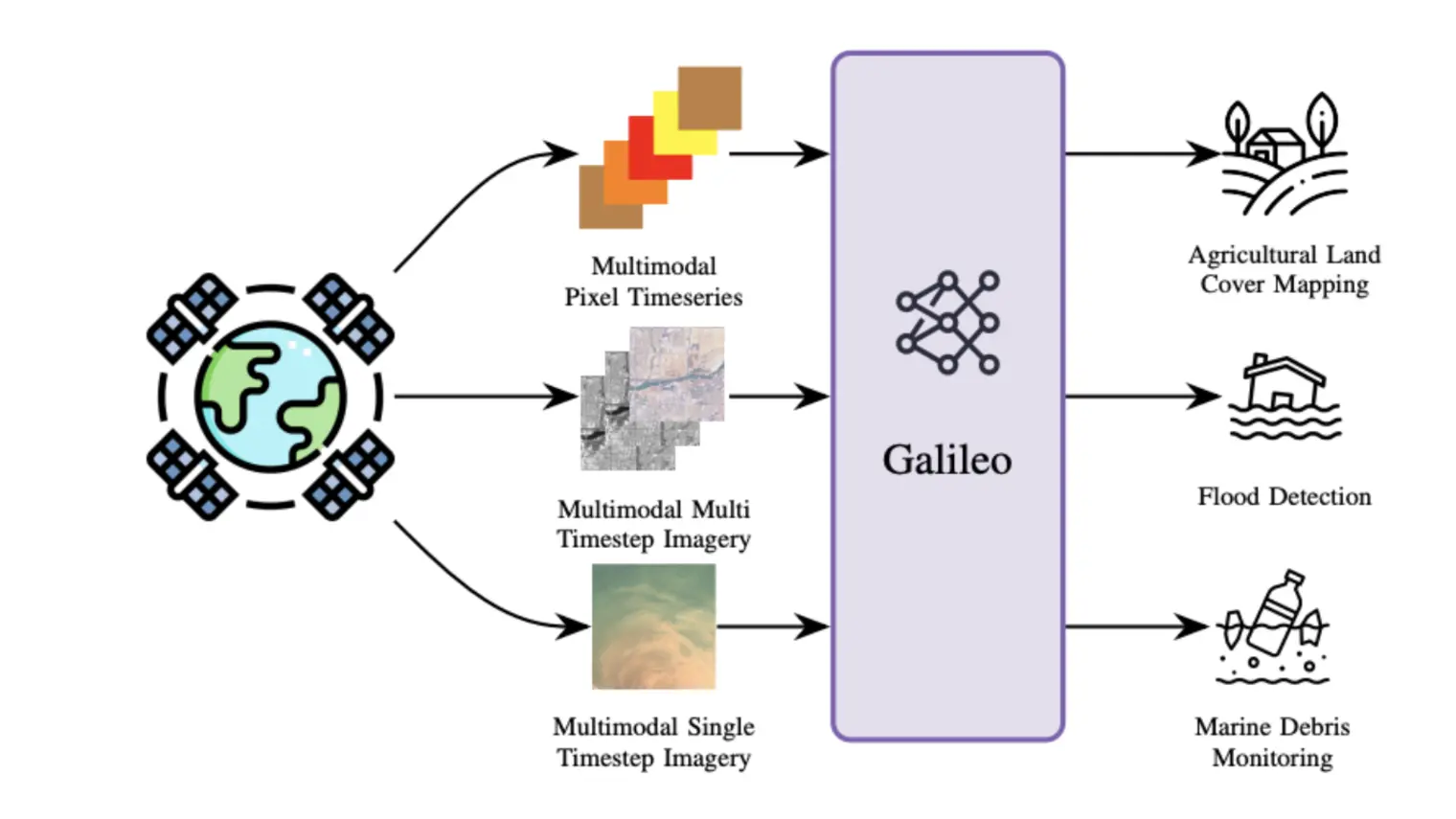
Abstract. Mountain snow is an important component of the cryosphere that directly affects downstream livelihoods. Accurate monitoring of mou… (see more)ntain snow is crucial, yet remains challenging due to complex topography and frequent cloud cover. Although combining data from multiple Earth Observation (EO) satellites can improve spatial and temporal coverage, extracting Fractional Snow Cover (FSC) from sensors with different spatial and temporal resolutions remains difficult. AI-based Earth foundation models can process diverse sensor inputs and have been successfully applied to various remote sensing tasks; however, they often lack snow-specific design considerations. This paper presents SnowGalileo, a pre-trained transformer model designed to integrate EO data to map snow-covered areas. We evaluated SnowGalileo's potential for generating daily, gap-free FSC maps at 100m resolution in mountainous regions. SnowGalileo combines one week of satellite time-series data from multiple sensors, including Sentinel-1, Sentinel-2, Landsat, Sentinel-3, MODIS, and VIIRS, with topographic, land cover, and meteorological information to predict FSC for a given day. The model was pre-trained using masked autoencoding and fine-tuned using labeled data from various mountain ranges across the Northern Hemisphere. In addition to clear-sky conditions, SnowGalileo is evaluated under a wider variety of conditions than was previously possible, including cloud cover and lack of high-resolution (~10–30 m) satellite imagery. For the Canadian Rockies and the Swiss Alps, respectively, SnowGalileo achieves RMSEs of 0.099 and 0.124 on clear days, 0.144 and 0.209 on cloudy days, 0.185 and 0.262 on days without high-resolution imagery, and 0.200 and 0.299 on cloudy days without high-resolution imagery. SnowGalileo also consistently outperforms random forests, support vector regressors, and multi-layer perceptrons. While the current product is a proof of concept that has undergone limited validation across geographic regions, operates on 1km × 1km tiles rather than full maps, and has restricted capabilities in challenging conditions, this approach could ultimately enable the continuous, gap-free operational generation of FSC time series for mountain regions worldwide.
Bayesian Decision-Time Inference for In-Context Reinforcement Learning from Suboptimal Data
In-context reinforcement learning (ICRL) promises rapid adaptation without parameter updates, but standard supervised objectives often fail … (see more)when pretraining data is generated by suboptimal behaviour policies. In these regimes, logged actions are unreliable labels while rewards still provide value-relevant information. To address this, we introduce SPICE, a Bayesian decision-time inference method that shifts online ICRL from action-logit prediction to approximate posterior inference over action values, requiring neither expert action labels nor algorithmic learning traces. SPICE learns a task-conditioned value prior with a transformer value ensemble and, at test time with parameters frozen, fuses this prior with kernel-weighted context evidence via a closed-form Gaussian fusion update. The resulting estimates drive a posterior-UCB controller, enabling principled online exploration and adaptation without gradient updates. A stochastic-bandit analysis shows logarithmic regret growth for the fixed-prior controller under scheduled exploration, while quantifying the additional early cost caused by inaccurate prior estimates. Across bandits, Darkroom, image-based MiniWorld, and continuous building control, SPICE adapts more effectively from suboptimal data than supervised ICRL baselines.
Catalyst GFlowNet for electrocatalyst design: A hydrogen evolution reaction case study
Efficient and inexpensive energy storage is essential for accelerating the adoption of renewable energy and ensuring a stable supply, despit… (see more)e fluctuations in sources such as wind and solar. Electrocatalysts play a key role in hydrogen energy storage (HES), allowing the energy to be stored as hydrogen. However, the development of affordable and high-performance catalysts for this process remains a significant challenge. We introduce Catalyst GFlowNet, a generative model that leverages machine learning-based predictors of formation and adsorption energy to design crystal surfaces that act as efficient catalysts. We demonstrate the performance of the model through a proof-of-concept application to the hydrogen evolution reaction, a key reaction in HES, for which we successfully identified platinum as the most efficient known catalyst. In future work, we aim to extend this approach to the oxygen evolution reaction, where current optimal catalysts are expensive metal oxides, and open the search space to discover new materials. This generative modeling framework offers a promising pathway for accelerating the search for novel and efficient catalysts.
Identifying birdsong syllables without labelled data
Identifying sequences of syllables within birdsongs is key to tackling a wide array of challenges, including bird individual identification … (see more)and better understanding of animal communication and sensory-motor learning. Recently, machine learning approaches have demonstrated great potential to alleviate the need for experts to label long audio recordings by hand. However, they still typically rely on the availability of labelled data for model training, restricting applicability to a few species and datasets. In this work, we build the first fully unsupervised algorithm to decompose birdsong recordings into sequences of syllables. We first detect syllable events, then cluster them to extract templates -- syllable representations -- before performing matching pursuit to decompose the recording as a sequence of syllables. We evaluate our automatic annotations against human labels on a dataset of Bengalese finch songs and find that our unsupervised method achieves high performance. We also demonstrate that our approach can distinguish individual birds within a species through their unique vocal signatures, for both Bengalese finches and another species, the great tit.
Estimating Individual Tree Height and Species from UAV Imagery
Accurate estimation of forest biomass, a major carbon sink, relies heavily on tree-level traits such as height and species. Unoccupied Aeria… (see more)l Vehicles (UAVs) capturing high-resolution imagery from a single RGB camera offer a cost-effective and scalable approach for mapping and measuring individual trees. We introduce BIRCH-Trees, the first benchmark for individual tree height and species estimation from tree-centered UAV images, spanning three datasets: temperate forests, tropical forests, and boreal plantations. We also present DINOvTree, a unified approach using a Vision Foundation Model (VFM) backbone with task-specific heads for simultaneous height and species prediction. Through extensive evaluations on BIRCH-Trees, we compare DINOvTree against commonly used vision methods, including VFMs, as well as biological allometric equations. We find that DINOvTree achieves top overall results with accurate height predictions and competitive classification accuracy while using only 54% to 58% of the parameters of the second-best approach.
BATIS: Bayesian Approaches for Targeted Improvement of Species Distribution Models
Benjamin Akera
Mélisande Teng
Species distribution models (SDMs), which aim to predict species occurrence based on environmental variables, are widely used to monitor and… (see more) respond to biodiversity change. Recent deep learning advances for SDMs have been shown to perform well on complex and heterogeneous datasets, but their effectiveness remains limited by spatial biases in the data. In this paper, we revisit deep SDMs from a Bayesian perspective and introduce BATIS, a novel and practical framework wherein prior predictions are updated iteratively using limited observational data. Models must appropriately capture both aleatoric and epistemic uncertainty to effectively combine fine-grained local insights with broader ecological patterns. We benchmark an extensive set of uncertainty quantification approaches on a novel dataset including citizen science observations from the eBird platform. Our empirical study shows how Bayesian deep learning approaches can greatly improve the reliability of SDMs in data-scarce locations, which can contribute to ecological understanding and conservation efforts.
Learning a Spatial Partitioning and its Causal Relations from Temporal Data
Scientific research often seeks to understand the causal structure underlying high-level variables in a system. For example, climate scienti… (see more)sts study how phenomena, such as El Niño, affect other climate processes at remote locations across the globe. However, scientists typically collect low-level measurements, such as geographically distributed temperature readings. From these, one needs to learn both a mapping to causally-relevant latent variables, such as a high-level representation of the El Niño phenomenon and other processes, as well as the causal model over them. The challenge is that this task, called causal representation learning, is highly underdetermined from observational data alone, requiring other constraints during learning to resolve the indeterminacies. In this work, we consider the task of partitioning observed variables into disentangled factors, such as extracting regions from geographically gridded measurement data in climate research or capturing brain regions from neural activity data. We demonstrate the identifiability of the resulting model and propose a differentiable method, Causal Discovery with Single-parent Decoding (CDSD), that simultaneously learns, from temporal data, the underlying latents and a causal graph over them. We assess the validity of our theoretical results using simulated data and showcase the practical validity of our method in an application to real-world data from the climate science field.
Understanding Representation Gaps across Scales in Tropical Tree Species Classification from Drone Imagery
Sulagna Saha
Evan M. Gora
Adriane Esquivel Muelbert
Ian R. McGregor
César Gutiérrez
Vanessa E. Rubio
Accurate classification of tropical tree species from unoccupied aerial vehicle (UAV) imagery remains challenging due to high species divers… (see more)ity and strong visual similarity among species at typical image resolutions (centimeters per pixel). In contrast, models trained on close-up citizen science photographs captured with smartphones achieve strong plant species classification performance. Recent advances in UAV data acquisition now enable the collection of close-up images that are spatially registered with top-view aerial imagery and approach the level of visual detail found in smartphone photographs, with the trade-off that such high-resolution photos cannot be acquired for many trees. In this work, we evaluate the performance of existing methods using paired top-view and close-up UAV imagery collected in a species-rich tropical forest. Through fine-tuning experiments, we quantify the performance gap between vision foundation models and in-domain generalist plant recognition models across both image types (high-resolution close-up versus coarser-resolution top-view imagery). We show that classification performance is consistently higher on close-up images than on top-view aerial imagery, and that this performance gap widens for rare species. Finally, we propose that self-supervised representation alignment across these two spatial scales offers a promising approach for integrating fine-grained visual information into canopy-level species classification models based on top-view UAV imagery. Leveraging high-resolution close-up UAV imagery to enhance canopy-level species classification could substantially improve large-scale monitoring of tropical forest biodiversity.