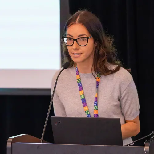
Mélisande Teng was awarded the "overall best paper" prize for Bird Distribution Modelling using Remote Sensing and Citizen Science data at the workshop dedicated to using AI to fight the climate crisis at the ICLR 2023 conference in Kigali, Rwanda.
A PhD student at Université de Montréal and Mila under the co-supervision of Mila founder and Scientific Director Yoshua Bengio and Professor Hugo Larochelle, she presented her work on bird distribution modelling aimed at better understanding the relationships between species and their habitats and ultimately facilitating decision-making on ecosystem preservation.
Mapping species distribution
For the past two years, she has been working on a project initiated by Mila researcher David Rolnick mapping the distribution of bird species in the USA using satellite image data and sighting reports from users of the bird-tracking database Ebird.
"The idea with satellite imagery is to focus on locations where there have been sightings and train a model that can predict the probability of encountering a certain species at a certain location based on the satellite image," Mélisande Teng explains.
This project was designed to facilitate the work of ecologists trying to map the distribution of species to better understand ecosystems by using easily accessible satellite images and citizen science data to improve the computer model while minimizing costs.
To her, the real value of machine learning lies in the models' ability to process and interpret very large volumes of data, as "trying to model co-occurrences between many different species is extremely difficult with traditional ecology methods," she explains.
With a strong commitment to the practical applications of AI research, she took great care in adapting her work to available data and selecting those most likely to be useful to ecologists.
Her model focuses on the distribution of 684 bird species in June in the United States, where data is abundant, but ultimately, she would like to extend it to other seasons, territories and species, and integrate temporal data to study changes from one year to the next.
Expanding the field of research
This project could be generalized and applied to other tasks, such as butterfly or tree distributions. One of the article's co-authors, Benjamin Akera, wants to adapt it to East Africa, and thus transfer the model to another reality with less data and different species.
"Beyond simply modeling the distribution of bird species, the initial ambition was to use satellite images and citizen science to find representations (embeddings) of what an ecosystem is because species interact with each other, but not just between bird species."
"By having a global picture of what an ecosystem is, we can then use it for many different tasks in ecology," according to Mélisande Teng.
According to her, AI has real potential for tackling issues relating to climate change and biodiversity: she contributed to Mila's "This climate doesn't exist" project aimed at raising awareness of the consequences of climate change before embarking on her current project.
"I really like this project because for me, science is a way of empowering citizens, we can't just do research in our little ivory tower."
"I see science as a way of restoring that link between researchers, citizens and decision-makers. My project is just a drop in the ocean, but everyone in their own field can try to make their own small contribution," she concludes.


