A groundbreaking model to easily monitor the health of our planet
All around us, satellites take the pulse of our planet’s health via a wide variety of sensors, recording crucial insights that can help us tackle major challenges like food insecurity and disaster response. But turning this massive, complex data stream into action has traditionally required expensive teams of experts, on top of being inadequate for fast-moving crisis situations requiring near real-time analysis.
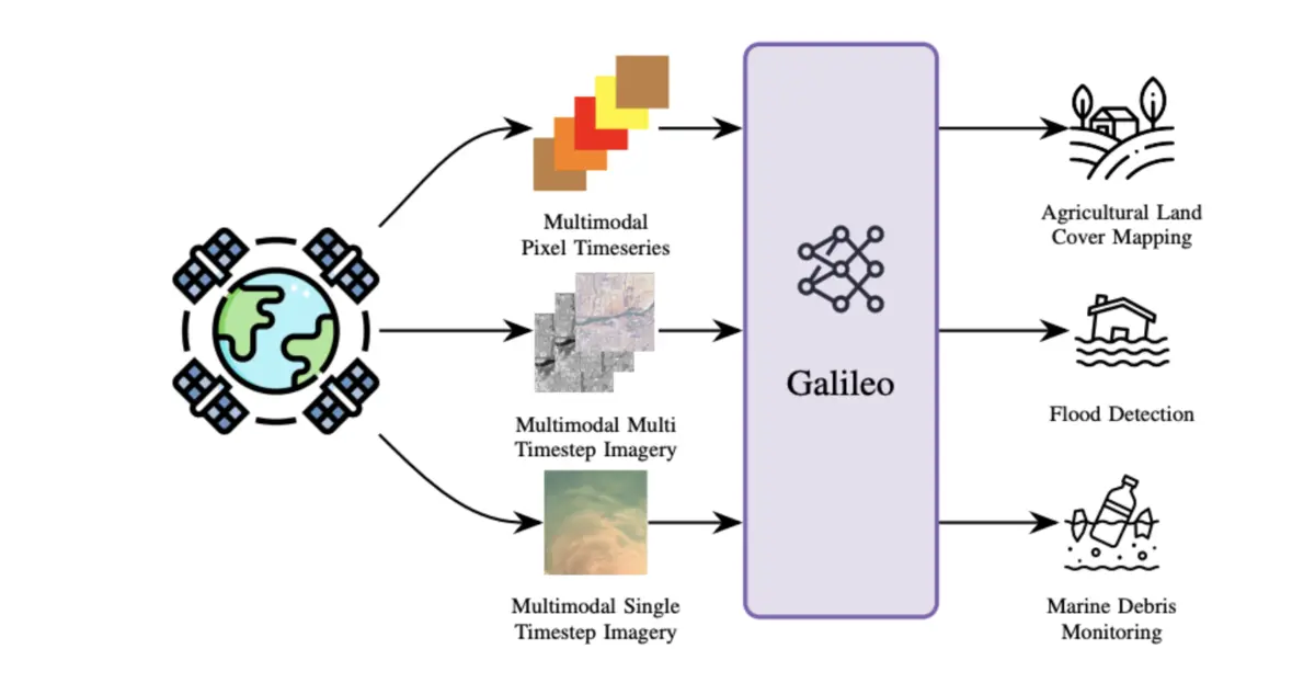
Our AI foundation model for Earth observation, Galileo, is a groundbreaking shift in open satellite and human activity data processing. Galileo uses self-supervised learning to “teach” itself by finding patterns in vast archives of unlabeled data from decades of Earth monitoring - this requires less costly, hand-labeled ground-truth data.
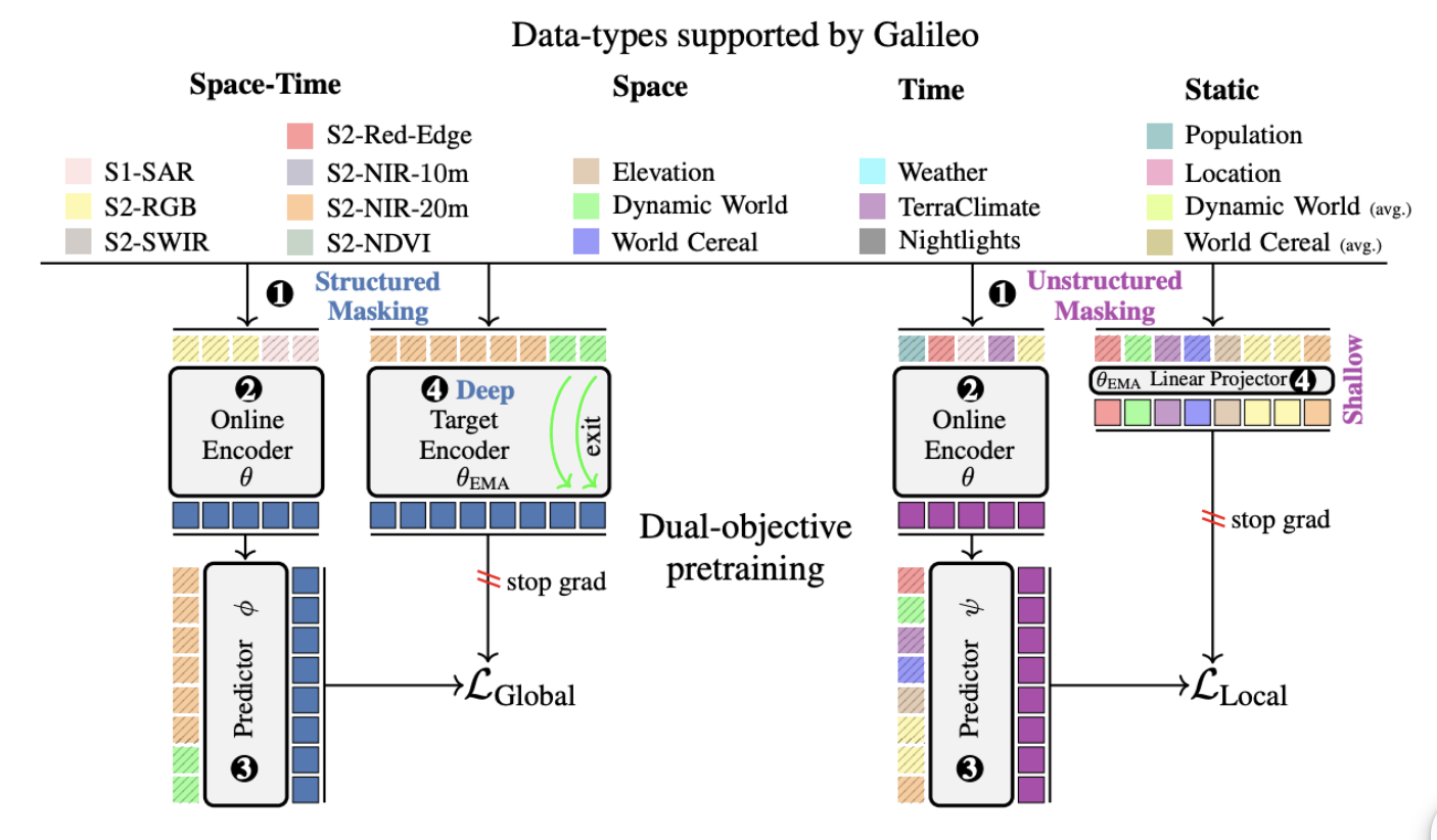
Galileo exploits the structure of Earth observation data - including temporal structure, spatial structure and relationships between different sensors - to significantly outperform previous self-supervised methods.
From multispectral optical data to synthetic aperture radar readings and from climate to land cover maps, Galileo allows anyone to gather and make sense of this huge trove of publicly accessible data to better understand the metrics of our planet’s health and, ultimately, act on the most alarming signals.
Making sense of data from multiple sources
Optical imagery, cloud-penetrating radar, elevation, weather, and even nighttime lights: Galileo fuses information from many sources in one place to build a rich, holistic understanding of a specific area.
This level of granularity and multimodality is unparalleled in a free, open-source model, and allows anyone to build their own tools to monitor specific metrics and areas of interest.
Galileo processes both spatial and temporal data seamlessly to help us understand how landscapes evolve over time. This is especially crucial in domains like agriculture, where a field looks very different from seedling to harvesting season. It is also crucial for rapidly evolving situations like mapping crops in a conflict zone, assessing flood damage, or monitoring wildfires over a large area.
With a novel learning algorithm designed specifically for remote sensing, Galileo learns both "global" big-picture context and "local" fine-grained details simultaneously. This allows it to perform well at tasks involving objects of vastly different scales, from single objects like small boats to massive glaciers to forests affected by wildfires.
Democratizing access to Earth data to inform action
Galileo seeks to democratize access to Earth data by empowering non-experts to get meaningful answers quickly and efficiently without requiring a heavy technical background or any specific set of skills beyond basic programming abilities.
Our method can for example be used to:
- Monitor wildfire risk: We used Galileo to create maps of Live Fuel Moisture Content (LFMC), a key variable for predicting wildfire behaviour that is otherwise impossible to measure at scale.
- Map global agriculture: Galileo’s predecessor model, Presto, now serves as the backbone for the WorldCereal project, a major European Space Agency-funded project to create cropland maps at scale and guard against food insecurity.
- Empowering rapid response on the ground: A user with basic programming knowledge can now generate a high-quality cropland map for an entire country in just a dozen lines of code (link), speeding up a task that previously took months.
By making Earth observation data more powerful, accessible and insightful, Galileo can help usher in a world where policymakers and organizations are equipped with the insights they need to build a safer, more resilient future.
Galileo is available for free here: https://github.com/nasaharvest/galileo